
Somehow Clancy Takia knows the way across the Pacific Ocean, without GPS or sextant or sometimes even the stars to guide him.
Ask him how he manages to navigate from atoll to atoll in the Marshall Islands, midway between Hawaii and Australia, and he might mention the swell of the waves or the spiritual qualities of the sea.
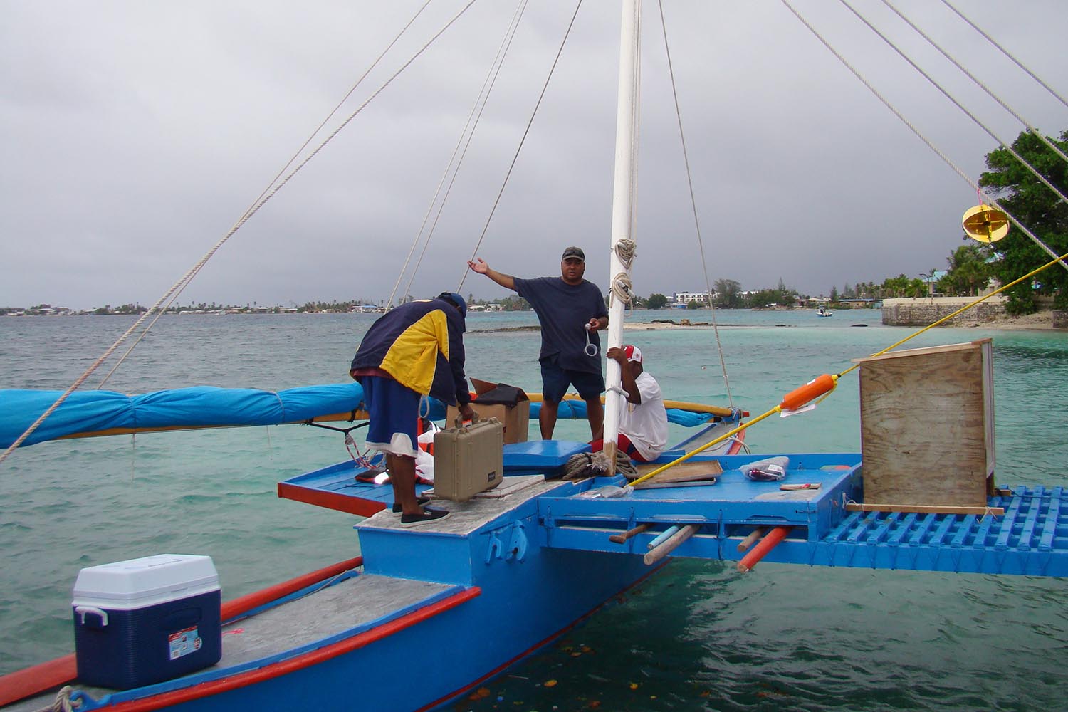
This week, scientists from the UK will try to establish exactly how he does it. Takia will sail from Majuro, the Marshalls’ capital, 75 miles north to Aur atoll, with a team including psychologists from University College London and the University of Stirling.
They will monitor Takia, their catamaran, and others on board with technology usually confined to a laboratory to understand the brain of a Marshallese “wave pilot” – and the brains of untrained passengers trying to work out where they are when all they can see is ocean and sky.
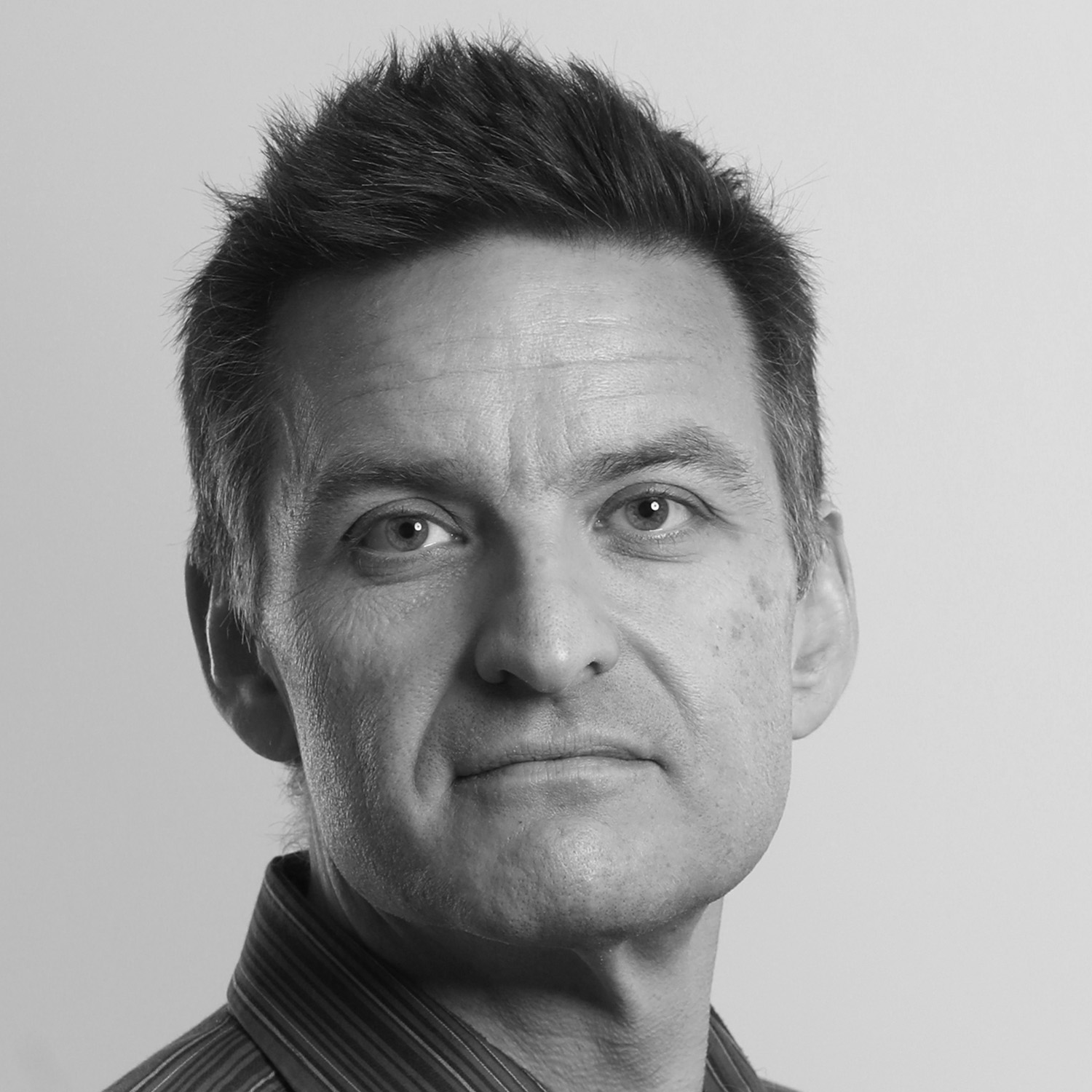
The research is important for several reasons, according to Professor Hugo Spiers from UCL’s department of experimental psychology. The last master navigator, or ri-meto, died in 2017, and this expert knowledge of wave-piloting could have been lost for ever when many locals were displaced to allow nuclear testing in the islands.
“There’s a real drive for cultural revival,” Spiers said. “Can we reinstate, enhance and empower populations? And that actually includes people sitting in London who are overly using their GPS.” Several studies indicate that smartphone use has atrophied our sense of direction.
Another motivation is simply to understand how humans solve problems. Dr Pablo Fernandez Velasco will equip the catamaran with accelerometers to record the effect of the ocean waves, and match them with brain waves taken from electroencephalograms (EEGs) of everyone on board. They will also record blood flow in the brain using functional near-infrared spectroscopy– a wire-studded cap, as well as using eye-tracking and 360-degree motion capture.
And there is a third reason: Alzheimer’s disease.
“One of the earliest symptoms [of Alzheimer’s] is being disoriented in space,” Spiers said. “People become lost. In fact, it’s argued that occurs before people have memory problems. So understanding people's changes in their navigation behaviour can be a very useful monitoring tool.”
‘If you’re just a couple of degrees off course, the next thing you’re likely to hit is the polar Arctic’
‘If you’re just a couple of degrees off course, the next thing you’re likely to hit is the polar Arctic’
Spiers and his colleagues have spent decades building technology to test people’s navigation behaviour, often on London’s cabbies, who need to spend at least two years acquiring “the Knowledge” so they know their way around the capital unaided, before they can get their licence. Black cab drivers are also the least likely of occupation groups to develop dementia, and scans show they have a more developed hippocampus, a brain region associated with spatial memory.
Newsletters
Choose the newsletters you want to receive
View more
For information about how The Observer protects your data, read our Privacy Policy
The Marshall Islands research will help develop a neuropsychological test that it is hoped can be applied around the world.
This is the second scientific journey wave pilots have made to Aur, after one in 2016 with Dr Joe Genz, an anthropologist interested in the Marshallese concept that navigators can feel the di lep, or backbone, of swells like a road between islands.
The Marshalls are two chains of islands running parallel to the main trade winds. Waves bounce off them in patterns mapped in Marshallese stick charts. These patterns are imperceptible to the untrained, and Spiers is curious as to whether they are felt through the sway of the boat or from visual cues, or both.
What is amazing, he says, is that the charts have codified the capacity to show where an island is, despite its being out of sight.
“If you’re just a couple of degrees off course, the next thing you’re likely to hit is the polar Arctic,” he said. “It’s not just getting lost in London. You cannot go wrong. It’s life and death.”
Fortunately for those on board, the catamaran also has GPS.
•
This article was amended on 7 August 2025 to clarify the identity of the Marshallese wave pilot taking part in the study as Clancy Takia, not Alson Kelen.
Photograph by Giff Johnson/AFP via Getty