

This article first appeared as part of the Daily Sensemaker newsletter – one story a day to make sense of the world. To receive it in your inbox, featuring content exclusive to the newsletter, sign up for free here.
The UN has warned the world to prepare for a Super El Niño that could make 2027 the hottest year on record.
So what? The world should treat it as a postcard from the future. A dramatic spike in global temperatures over the next few months, if it comes, will serve as a demonstration of the
•
multilevel weather impacts of a hotter planet;
•
durability of climate denialism in the face of reality; and
•
resilience of society to temperatures that could become commonplace.
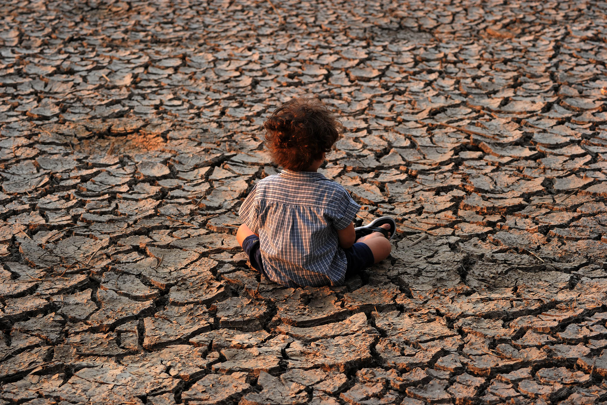
Back to school. El Niño is a natural phenomenon characterised by higher sea surface temperatures in the central and eastern Pacific Ocean. For up to a year at a time, it can increase heavy rainfall, bring warmer weather and trigger droughts and hurricanes.
Fuel on the fire. Climate change does not increase the intensity of El Niño, but it was less of an issue when it acted on lower baseline temperatures. António Guterres, the UN secretary-general, said the conditions would “pour fuel on the fire of a warming world”.
Case in point. The last El Niño wasn’t as strong as its predecessors. But when combined with the amplifying power of climate change, it helped make 2024 the hottest year on record. South America was badly hit. Some rivers in the Amazon basin reached their lowest levels in more than a century, while record-breaking rains in southern Brazil displaced more than half a million people.
She’s (probably) coming. The World Meteorological Organization said on Tuesday that El Niño has an 80% chance of forming before September, and a 90% chance before November.
Buckle up. Although a “Super El Niño” is not an official classification, there are fears that we might be about to witness a big one. Most models project it to be at least moderate, with some national weather agencies forecasting the strongest in a decade.
An ill omen. Subsurface conditions in the tropical Pacific are unusually warm at the moment, at more than 6C above average, which is what has got scientists worried.
Warning from the past. It is not out of the question that this event marks the early stages of the worst El Niño since 1877, when it led to catastrophic droughts, unseasonal monsoons and crop failures. The resulting famine killed north of 50m people, or roughly 4% of the global population. It has been called “arguably the worst environmental disaster to ever befall humanity”.
Warning of the present. Scientists are much better prepared these days, tracking El Niño development day-by-day with thousands of instruments in the ocean. This gives governments the ability to anticipate and mitigate the impacts on vulnerable populations. But any response will be inevitably complicated by food insecurity, government instability, inflation and conflict. Bill McKibben, the environmentalist, said in February that the world should “prepare for bedlam”.
Warning for the future. El Niño events are becoming tests of how well-prepared societies and systems are to handle the effects of runaway climate change. The worst forecasts for the upcoming El Niño suggest it could lead to a short-term global temperature rise that exceeds 3C, higher than the 2.7C recorded in 1877. Last year, the UN said the world is likely to exceed 1.5C warming and, under current policies, is on track for about 2.8C this century.
What’s more… If the more extreme forecasts for El Niño do not come to pass, it is likely that scientists will be accused of scaremongering. Instead the world should breathe a sigh of relief.
Photograph by Orlando Sierra / Getty Images
Newsletters
Choose the newsletters you want to receive
View more
For information about how The Observer protects your data, read our Privacy Policy